Bodpathri Trek

Introduction

Arrive: Srinagar, Kashmir
Depart: Srinagar Kashmir
Best Time: June to September
Duration: 6 Days
Trek-Distance: 52 KM
Highest Altitude: Bandsar Pass (3980m)
Activity Level:
Activity Level 3C
Level 3
PRICE
INR 16100/Per Person

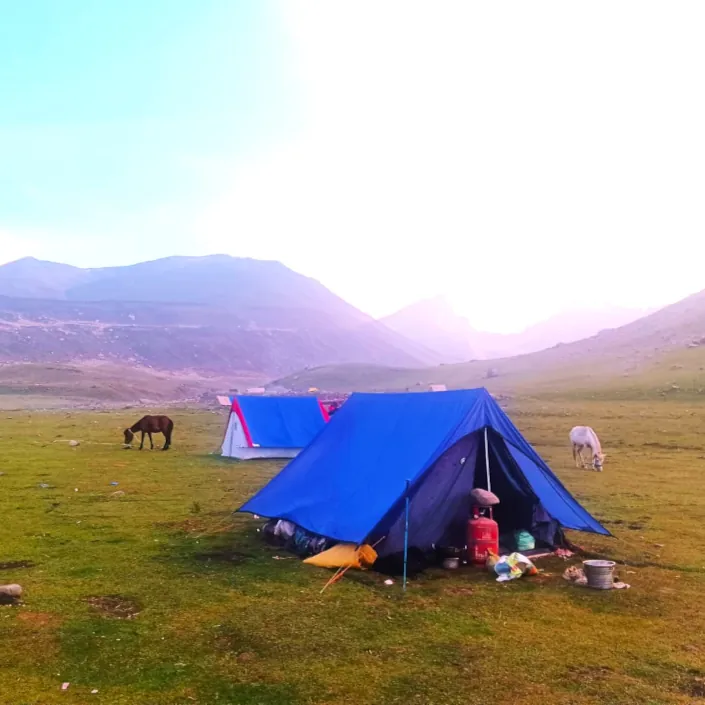
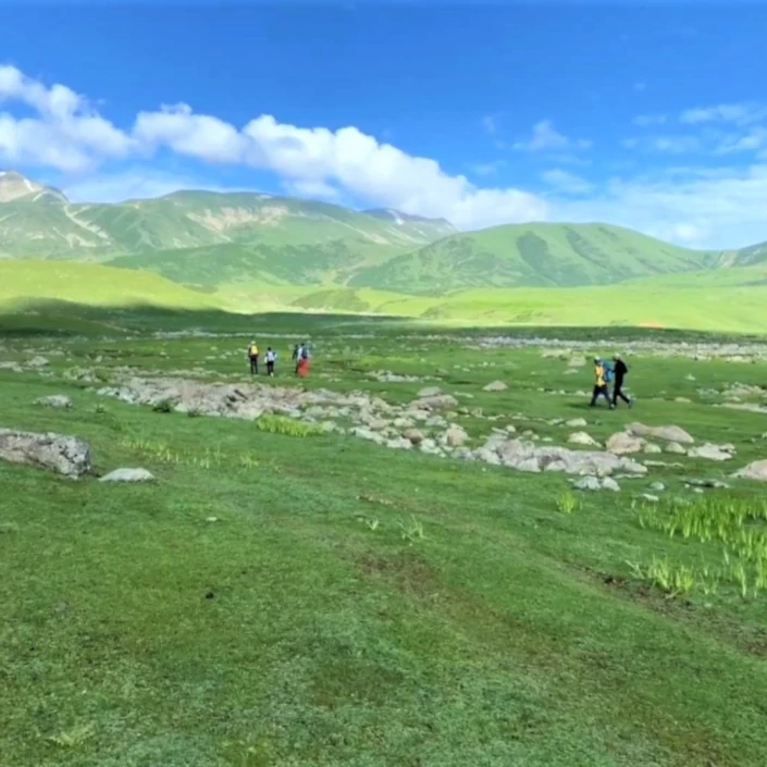
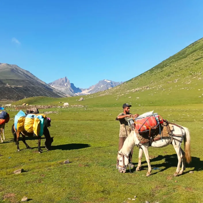
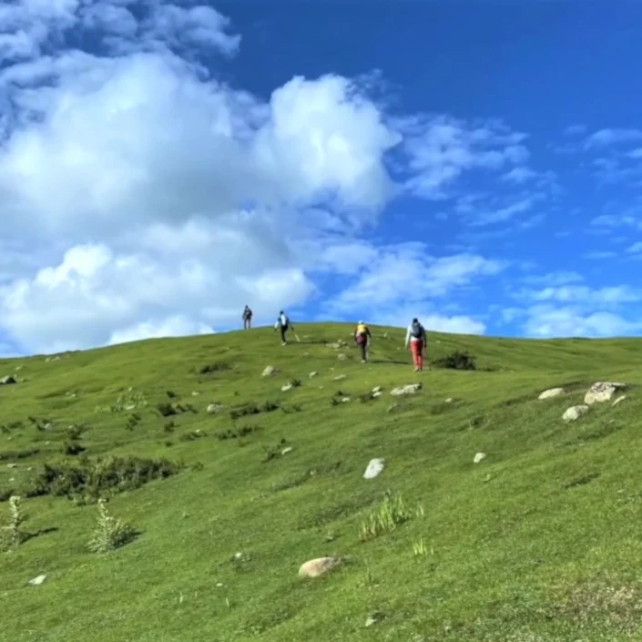
Bodpathri Trek starts at Doodpathri and end at Tosamaidan. Both are hillstations and very popular sightseeing and picnic destinations. The trek is a natural hiking trail that offers very good peace of mind. It showcases immense natural beauty and plenty of tranquility. Located about 55 km away from Srinagar, this offbeat trek is a great choice if you want to experience the raw and seemingly untouched beauty of Kashmir. It is the best fit for the mountain lovers who want to escape the crowd of Great Lakes or Tarsar-Marsar.

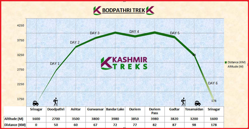
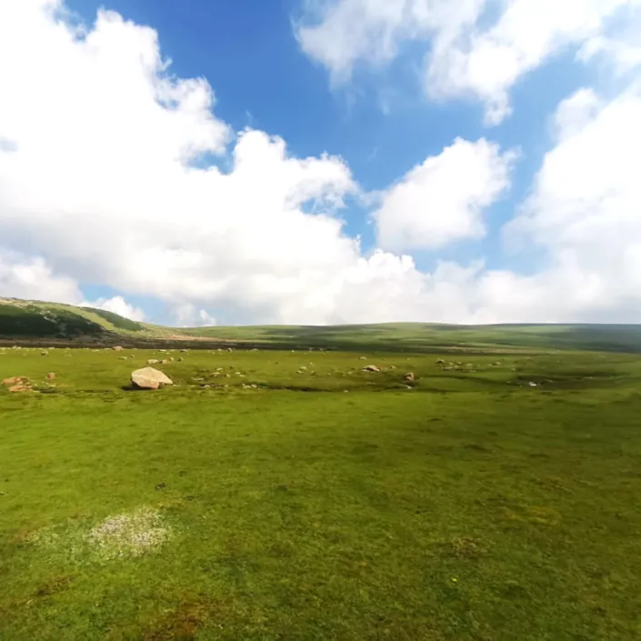
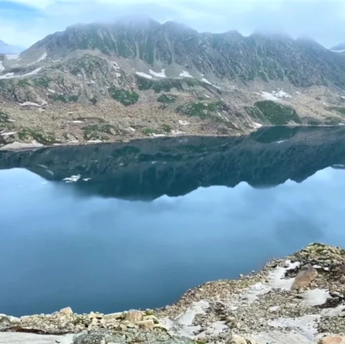
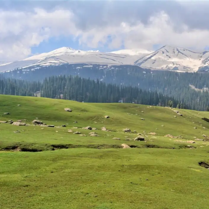
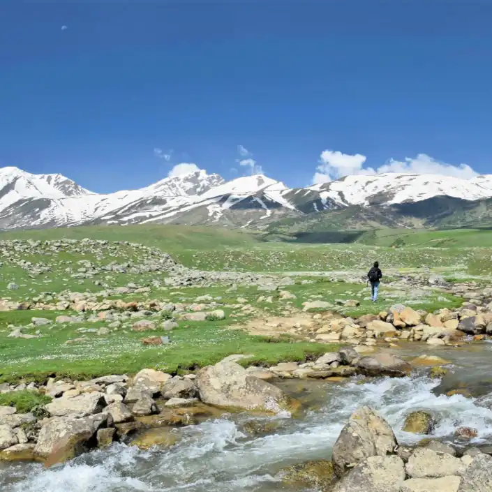
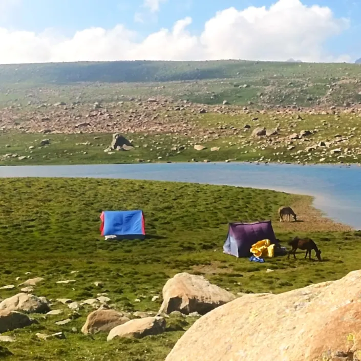
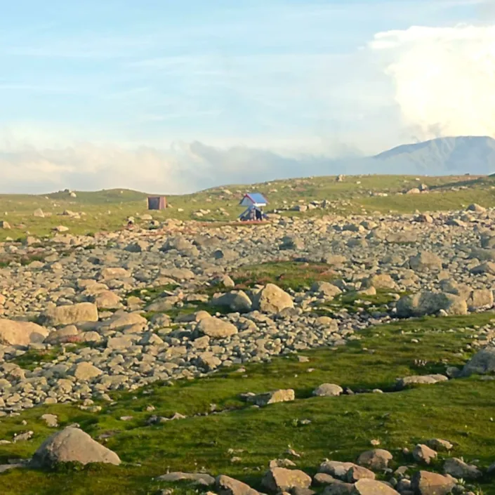
The Bodpathri Trek experiences six alpine Lakes, amidist snowcapped mountains. This region of Kashmir lieas within the towering heights, lush green meadows of Pir Panjal mountain range

The Bodpathri Trek expedition is no walk in the park. Arduous days, steep mountain passes, and altitudes approaching 4100m demand a sure-feet and a good amount of physical and mental fitness. The difficulties of the trek are rewarding and the challenges are worth it for the sense of achievement. This trek of the Kashmir is the most beautiful and most serene of all treks in the Himalayas.

While planning your trek, as a beginner keep the following points in consideration:-
  • you feel fit enough to trek for hours.
  • you walk two or three kilometers daily.
  • you don’t have any breathing problems.
  • you are not scared of heights.

Inclusions

What’s included in the Price?

  • All road transport by private ac cars

    For Day 1, from Srinagar airport to Doodpathri base camp; Day 7, from Tosamaidan to Srinagar Hotel and Day 8 for airport or Bus Station drop

  • 5 nights of tented accommodation

    Twin sharing; 2 persons in a 3-man-tent

  • All trekking gear included

    Tents (twin sharing), dining and kitchen tent, toilet tents, sleeping bags and mats.

  • Local Guides and Cooking staff

    Languages; English, Urdu, Hindi and Kashmiri

  • All cooking utensils

    LPG stoves

  • Offloading

    Horses to carry your backpack (below 20kgs) throughout the trek (except day sack)

  • Meal plan- Vegetarian meals including eggs and cheese, unless specified

    Trek-4 meals per day (Breakfast, Lunch, Tea snacks, Dinner)

  • Trek Permits

    Wildlife/ Forest Permits

  • Drinking Water

    Packed bottled mineral drinking water (2 ltrs per person) on first day of the trek. Later on boiled drinking water at camp sites in the morning & evening hours.

  • First Aid Kit

    With Medical Oxygen

  • Trek Insurance

    For trek-Insurance, we need a medical fitness form. You can download the proforma here and after filling in the details, email us a copy to info@kashmirtreks.com

What’s not included in the Price?

  • International or domestic flights
  • Visa
  • Personal clothing and equipment
  • Any medical costs

    Costs associated with a medical incident, such as your evacuation from the mountain and/ or hospitalization (for which you should have travel insurance)

  • Optional trips or excursions
  • Tips for local staff and guides.

Itinerary

Brief Itinerary

Day 1:- Srinagar to Doodhpathri

  • Pickup from Srinagar airport or Hotel
  • 50 kms drive, approx 2 hours
  • Overnight Camping at Doodhpathri

(Transport, tea, dinner)

Day 2:- Doodhpathri-Ashtaar Valley

  • Altitude: 2700m to 3500m
  • 10 kms trek, approx 6 hours
  • Overnight camp at Ashtaar Valley

(Breakfast, lunch, tea, dinner)

Day 3:- Ashtaar to Gurwansar

  • Altitude: 3500m to 3800m
  • 7 km trek, approx 5 hours
  • Overnight camp at Gurwansar

(Breakfast, lunch, tea, dinner)

Day 4:- Gurwansar to Duriem via Bandsar Lake

  • Altitude: 3800m to 3850m via 3980m
  • 10 km trek, approx 7 hours
  • Overnight camp at Duriem

(Breakfast, lunch, tea, dinner)

Day 5:- Duriam to Gadtar

  • Altitude: 3800m to 3820m via 3950m
  • 10 km trek, approx 8 hours trek
  • Overnight camp at Gadtar

(Breakfast, lunch, tea, dinner)

Day 6:- Gadtar to Tosamaidan (trek) and drive to Srinagar

  • Altitude: 3820 to 3200m
  • 11 kms trek, approx 5 hours
  • 80 kms drive to Srinagar, approx 3 hours
  • Drop at Srinagar (Hotel or Airport)

(Breakfast, lunch, transport)

Detailed Itinerary

Day 1:- Srinagar to Doodhpathri

Our representatives cum driver will pick you up from Srinagar airport or hotel and drive you all the way to the Doodhpathri campsite. Doodpathri is a hillstation and very popular for sightseeing tourists. It is also a beautiful camping spot. The green meadows of Doodhpathri are quite similar to that of Gulmarg and the river flowing through the meadow gives you the hint of a similar scenery as that of Pahalgam. Tall pine trees loom around the meadows, making the meadows a perfect spot to camp for the night. You might even catch a few shepherds grazing their cattle around the meadows. You can roam around the meadows at your leisure in the evening and after a hearty dinner, retire to your camps for the night.

Day 2:- Doodhpathri to Ashtaar

Today is the first day of your trek and you begin with a gradual ascend from Doodhpathri towards Ashtar. Ashtar Valley is a rangeland located near the foothills of Mt. Tatakoti. Tatakoti is the highest point of the Pir Panjal Range, which comprises numerous mountain peaks. You may observe the Shali Ganga River flowing through the valley, which flows to Doodhpathri and joins the Doodh Ganga River around Wathoora. The River flows from the Ashtar glacier, which you can see on your right-hand side once you reach the valley. During July, the entire valley is covered in yellow and red blooms. From Ashtar Valley, it’s a level walk of about 2 km before you reach the Ashtar campsite.

Day 3:- Ashtaar to Gurwansar.

Today is also a fairly easy day of trekking as we trek to Gurwansar Lake. The trek is not difficult per se but what makes it a little tiring is that even though the ascent is gradual but the ascents are very long.

You cross some beautiful meadows and come across some river crossings on your way to Gurwansar Lake. The meadows are surrounded by a dense cover of pine trees, a beautiful sight to behold. This part of the trek is also great to spot a range of birds including the Golden Oriole. You will spot numerous sheep and lambs in the meadows herded by shepherds in the meadows. As you gain altitude, you will get inside cloud covers making for a surreal experience. The more you inch towards the lake, you will begin to see patches of snow depending on the time you are going on the trek.

The Gurwansar Lake sits in the middle of a meadow. We will camp by the lakeside tonight and in the vicinity of the campsite, you can spot numerous herbs like Saussurea costus, Taraxacum officinale, and Rheum Emodi.

Day 4:- Gurwansar to Duriem via Bandsar

From Gurwansar campsite, it’s 9 km to Duriem. We will start the day as early as we can, as we have a long distance to cover and the trail is also moderately difficult. Follow the slope towards the west of Gurwansar Lake to head to Duriem via Pamsar Lake. About 20 minutes into walking, you will come across a bouldered section. The boulder section can be quite thrilling and gives an adventurous feel to the trek, although, you definitely need a good deal of fitness to cross this section. Be mindful while you cross the boulders as some of the rocks may be loose and shift disrupting your balance. After a gradual hike through the boulder, Pamsar Lake becomes visible.

It is a huge lake and you may not see it all at once. As you slowly inch closer to the lake, it begins to reveal itself. The beautiful lake is surrounded by a serenity that will soothe your sense. Sit down, and relish a few quiet moments here before you head onwards on your journey towards Duriem.

From the lake, you have to ascend a ridge to reach Duriem. You will ascend through a boulder section to reach a ledge. Continue walking until you reach the top of the ridge and once you reach the top, you can start your descent towards Duriem. Before you arrive at your campsite, you will have a stream crossing, which is quite a refreshing experience after a tiring day. We will pitch our tents after the stream crossing and retire for the night after dinner.

Day 5:- Duriem to Gadtar

Today is going to be a long and interesting day as you spot not one or two but five beautiful lakes. Today also we will start the day early. From the campsite, you will start ascending towards to reach the first lake. After climbing for about 2.5 km, you will reach a point where you will go off the trail. From here you will start trekking towards Bodhsar Lake viewpoint. The viewpoint is about half a kilometer away towards the left. From this viewpoint, you can see the Duriem campsite. Also, keep an eye out for Tratsar Lake, also known as Lokutsar Lake.

After you have spent some time taking in the views and enjoying the beauty of the lakes, you will return back to the point where you started hiking toward Bodhsar Lake. Now you will ascend in the opposite direction through a bouldery section. The ascend becomes steep pretty soon. And continues for about a kilometer until you reach a flat portion of the ridge. This is a picturesque vantage point that unfolds a panoramic view of the lakes in front of you. Spending some time here, you will begin descending from the ridge and after about an hour of descending, you will begin to ascend again until you reach Damamsar Lake. The highest point of the ridge will give a beautiful bird’s eye view of Damamsar Lake as well as Navkansar I and II. Rejoicing in this captivating view for some time, we will descend all the way to the Gadtar campsite for the overnight stay.

Day 6:- Gadtar to Tosamaidan

Today is the last day of trekking, albeit also the longest. Start early as you have quite a long distance to cover. The trek starts with a wonderful river crossing post which you start ascending to a grassy ledge. There will be a couple of stream crossings today. You will mostly stay around the same altitude as you make ascends and descends until you reach the top of the ridge. Once you reach the top, you will again descend towards the second river crossing of your day followed by a mud trail.

Follow the trail and you will come across a water source and the third stream crossing for the day. This is the last leg of your trek after the river crossing. You can rest for a while if you want. The Tosamaidan region starts at the end of the descent and it unfolds a very gorgeous vista in front of you, which is a pure treat to the eyes. Follow this trail and you will reach the road head soon. Once you reach the road head, mobile networks also start working. We take our lunch at a Restaurant and take our car drive back to Srinagar. Drop at Hotel or airport. End of Tour.

What to Carry?

The trek is supported by horses. You will need to carry only a light sack, weighing about 4-6kg for your items like passport, money, and camera gear. The following is a list of the items you should carry on the trek. If you have items that can not be used on the trek, you can store them at our houseboat or our office and take them back after returning from the trek.

  • Please note that only postpaid Indian mobile sim cards (Jio, Airtel and BSNL) work in Kashmir Valley. Cellular network signal is available intermittently on the mountain passes.
  • Passport or a valid ID card
  • Duffel Bag 60 liters
  • One Pair Trekking Shoes
  • One Pair Trail Approach Shoes
  • Trekking Pants
  • Hooded Rain Jacket
  • Shade Hat
  • One Pair Sunglasses
  • One Pair Liner Gloves
  • Small Size Day-Pack
  • Two Pair Trekking Socks
  • One Pair Sandals
  • Extra Warm Clothes
  • Warm Hooded Down Jacket
  • Sunscreen Cream
  • Lip Balm
  • Any Personal Medication

Fitness

Kashmir Treks are achievable by anyone with a healthy lifestyle and a good level of general fitness. Team members should be willing to be part of a team working together to achieve the goal of the expedition. As a team member, you should have an adventurous and robust spirit. The biggest challenge on this expedition will be the many consecutive days of challenging trekking across alpine terrain, much of which at altitudes of above 3000m.

Minimum fitness requirements
  • Trek: up to 7km per day.
  • Daily activity: up to 5 hours’ trekking per day.
  • Carry: up to 5kg in a day-sack.
  • Terrain: remote, uneven, snowy, icy, rocky, sometimes exposed terrain at up to 4200m.
  • Climate: Can be sunny in valleys and cold and windy at high altitudes. June and September months are cooler than those of July and August. Averages are 3000m, 1°C to 20°C.
  • Swim: not required though there will be stream crossings to make.